Industrial plants rarely remain the same throughout their lifecycle. Equipment gets replaced, piping is rerouted, structural modifications are made, and utilities are upgraded over time. Unfortunately, engineering drawings often fail to keep pace with these changes.
This is where 3D laser scanning has become an indispensable technology for industrial plants.
Instead of relying on outdated drawings or manual measurements, engineering teams can capture millions of highly accurate data points within hours and generate a precise digital representation of the facility. These point clouds can then be converted into intelligent 3D models that support engineering design, plant expansion, revamps, maintenance planning, and digital twin initiatives. Whether you’re upgrading an oil & gas facility, power plant, chemical plant, pharmaceutical unit, or manufacturing facility, industrial 3D scanning significantly reduces uncertainty while improving project accuracy and execution.
In this blog, we’ll explore everything you need to know about 3D laser scanning for industrial plants, right from understanding what it is and how it works to compare it with traditional surveying methods. We’ll also discuss its key applications across industrial facilities, walk you through the step-by-step process, highlight common mistakes to avoid during plant scanning projects, and explain how Rishabh Pro Engineering delivers accurate, engineering-ready 3D laser scanning solutions that support successful plant design, expansion, and modernization.
What Is 3D Laser Scanning?
3D laser scanning is a non-contact surveying technology that captures the exact geometry of physical assets using laser beams.
The scanner emits thousands, or even millions of laser pulses every second. Each laser pulse reflects from surrounding surfaces and returns to the scanner. By calculating the travel time of every laser beam, the system determines the precise X, Y, and Z coordinates of every surface.
The result is known as a point cloud, a dense collection of millions (or billions) of spatial data points representing the real-world environment.
Unlike traditional surveys that record only selected dimensions, industrial 3d scanning captures every visible object, including:
- Piping
- Structural steel
- Pressure vessels
- Tanks
- Equipment
- Pipe supports
- Cable trays
- Platforms
- Buildings
- HVAC systems
- Instruments
How Does 3D Laser Scanning Work?
At its core, 3D laser scanning is a fast and highly accurate way to capture the real-world conditions of an industrial facility. Instead of manually measuring individual assets, a laser scanner collects millions of measurements in just a few minutes, creating a complete digital record of the plant.
The scanner works by emitting laser beams that strike surrounding surfaces, such as piping, equipment, structural steel, and cable trays, and measuring the time it takes for the reflected light to return. Using this information, the scanner calculates the exact location of every point in three-dimensional space.
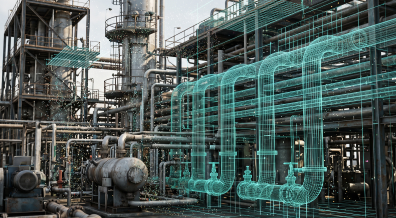
Each reflected laser pulse generates a precise coordinate, and millions of these coordinates come together to form a point cloud, a dense digital representation of the facility that accurately captures its size, shape, and layout.
Because a single scan cannot capture every angle, the scanner is positioned at multiple locations throughout the plant. These individual scans are then aligned and merged using specialized software, producing one seamless, highly accurate model of the entire site. The point cloud is cleaned to remove unwanted objects or noise before being converted into engineering-ready deliverables such as 3D CAD models, BIM models, or detailed as-built drawings.
The result is a reliable digital replica of the facility that engineers can use for plant modifications, equipment installations, retrofit projects, clash detection, and maintenance planning. By replacing manual measurements with comprehensive as-built data, 3D laser scanning reduces design uncertainties, minimizes costly rework, and enables faster, more informed engineering decisions.
3D Laser Scanning vs. Traditional Surveying
| Feature | 3D Laser Scanning | Traditional Surveying |
| Speed | Captures millions of points in hours | Manual measurements take days or weeks |
| Accuracy | Millimeter-level | Depends on operator |
| Data Density | Complete facility capture | Limited measurement points |
| Safety | Minimal access required | Frequent access to hazardous areas |
| Rework | Significantly reduced | Higher risk of missing measurements |
| Engineering Confidence | Very High | Moderate |
| Digital Twin Ready | Yes | Limited |
Traditional surveying remains useful for basic layouts, but industrial laser scanning offers a comprehensive digital record that supports the entire engineering lifecycle.
Applications of 3D Laser Scanning For Industrial Plants
The versatility of industrial 3d scanning makes it valuable across numerous engineering disciplines.
Brownfield Plant Modifications
- Existing facilities often have undocumented modifications.
- Laser scanning provides accurate as-built conditions before engineering begins, reducing design assumptions and avoiding costly field clashes.
Plant Expansion Projects
- When adding new process units or utility systems, engineers require accurate surrounding conditions.
- Industrial 3D laser scanning ensures new equipment integrates seamlessly with existing infrastructure.
Piping Design and Routing
Accurate piping models help designers:
- Route new pipelines
- Avoid existing systems
- Improve constructability
- Reduce fabrication errors
Structural Engineering
Structural teams use scan data for:
- Steel modifications
- Equipment supports
- Platform extensions
- Pipe rack expansion
- Foundation verification
Equipment Replacement
Large equipment replacements require precise dimensional information. Laser scanning enables engineers to verify:
- Equipment clearances
- Maintenance access
- Lifting paths
- Installation space
before procurement begins.
Clash Detection
Modern 3D models allow engineers to detect design conflicts digitally rather than during construction.
This dramatically reduces:
- Site delays
- RFIs
- Change orders
- Fabrication rework
Digital Twin Development
Laser scanning provides the foundation for digital twin initiatives by creating accurate as-built models that integrate with engineering databases and asset management systems.
The Industrial 3D Laser Scanning Process: Step by Step
A successful 3D laser scanning for industrial plants follows a structured workflow to ensure accurate data capture, reliable 3D models, and seamless integration into engineering and design processes. While the exact approach may vary depending on the project’s complexity, the typical workflow includes the following stages:
- Project Planning: Every successful scanning project begins with careful planning. During this phase, the project team defines the scope of work, identifies engineering objectives, assesses site-specific safety requirements, and develops a scanning strategy. Proper planning ensures that all critical plant areas are captured efficiently while minimizing disruptions to ongoing operations.
- Site Survey: Before scanning begins, engineers conduct a site walkthrough to determine the optimal scanner locations. Factors such as equipment congestion, accessibility, line of sight, and safety restrictions are carefully evaluated to maximize scan coverage and eliminate blind spots.
- Laser Scanning: Once the scan plan is finalized, high-precision laser scanners are deployed across multiple locations within the plant. Each scan captures millions of data points, creating a comprehensive digital record of the facility’s piping, equipment, structures, and surrounding infrastructure with millimeter-level accuracy.
- Point Cloud Registration: The data collected from individual scan positions is then processed and aligned into a single coordinate system through a process known as point cloud registration. This creates a unified, highly accurate representation of the entire facility that serves as the foundation for engineering and design activities.
- Quality Control and Data Validation: After registration, the point cloud undergoes a thorough quality check to verify its accuracy, identify any missing areas, and ensure complete coverage of the project scope. If required, additional scans are performed to fill data gaps before moving to the modeling stage.
- 3D Modeling: The validated point cloud is converted into an intelligent, engineering-ready 3D model using industry-standard software. Depending on project requirements, the model may include piping, structural steel, equipment, cable trays, HVAC systems, and other plant components, providing an accurate digital representation of the existing facility.
- Design Integration and Engineering: The final 3D model becomes a valuable engineering asset that supports a wide range of plant lifecycle activities, including:
- Detailed engineering and design
- Brownfield revamp and expansion projects
- Equipment installation and retrofit planning
- Clash detection and constructability reviews
- Fabrication and construction planning
- Maintenance planning and asset management
- Digital twin development
By following this systematic workflow, organizations can significantly reduce design errors, minimize costly rework, improve collaboration across engineering disciplines, and ensure that projects are executed with greater confidence and efficiency.
Common Mistakes to Avoid in Industrial 3D Scanning
While modern 3D laser scanning technology delivers highly accurate results, the success of a project depends just as much on proper planning, execution, and data processing as it does on the equipment itself. Avoiding the following common mistakes can help maximize the value of your scanning investment and ensure reliable engineering outcomes.
- Inadequate Scan Planning: A successful industrial laser scanning project begins long before the scanner is deployed. Failing to plan scanner positions, access routes, and coverage areas can lead to blind spots, incomplete data capture, and the need for additional site visits. Developing a comprehensive scan plan ensures that all critical assets and areas are captured accurately while minimizing downtime and fieldwork.
- Overlooking Project Objectives: Scanning an entire facility without clearly defining the engineering requirements can result in excessive data collection, longer processing times, and unnecessary project costs. Whether the objective is a plant expansion, equipment replacement, piping modification, or as-built documentation, the scanning strategy should align with the project’s specific goals and required level of detail.
- Using Inappropriate Scan Resolution: Choosing a lower scan resolution may reduce field time, but it can compromise the quality of the captured data. Insufficient detail may make it difficult to model small components, verify dimensions, or support precise engineering work, often leading to costly re-scanning efforts. Selecting the appropriate scan resolution based on the project’s accuracy requirements is essential.
- Poor Point Cloud Registration: A point cloud is only as reliable as its registration. If individual scans are not aligned correctly, the resulting model may contain dimensional inaccuracies that affect design, fabrication, and construction activities. Proper registration and quality verification ensure that the final dataset accurately represents the existing facility.
- Skipping Quality Assurance Checks: Before point clouds or 3D models are handed over for engineering, they should undergo thorough quality control to verify completeness, accuracy, and consistency. Identifying and correcting issues early helps prevent design errors, construction delays, and costly rework later in the project lifecycle.
- Stopping at Point Cloud Delivery: A registered point cloud is an invaluable source of information, but its full potential is realized only when it is transformed into an intelligent 3D engineering model. Converting scan data into detailed CAD or BIM models enables clash detection, design validation, retrofit planning, and seamless integration with engineering workflows, ultimately delivering far greater value than raw scan data alone.
Why Choose Rishabh Pro Engineering for Industrial Laser Scanning?
At Rishabh Pro Engineering (RPE), laser scanning is more than just data capture, it’s part of an integrated engineering workflow. By combining field expertise with multidisciplinary engineering capabilities, delivers engineering-ready as-built models that support plant upgrades, revamps, and greenfield or brownfield projects across oil & gas, power, chemicals, and manufacturing.
Unlike standalone scanning providers, our point cloud to 3d modeling services team can take a project from laser scanning → point cloud processing → intelligent 3D modeling → detailed engineering, helping clients reduce project risks and accelerate execution.
Project Spotlight
Case Study 1: FPSO Topside Module Laser Scanning to 3D Modeling
Client Challenge
A leading multinational energy company was developing an FPSO-based gas processing facility offshore in West Africa. The project required accurate as-built documentation of the FPSO topside and Gas Metering Unit (GMU) to support multidisciplinary engineering activities. Due to the complex offshore environment, congested layouts, and limited accessibility, relying on conventional measurement techniques could have introduced design inaccuracies, increased engineering risks, and delayed project execution.
Engineering Solution
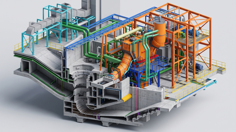
Rishabh Pro Engineering team developed FPSO topside module design and 3D model for the North American organization specializing in offshore oil and gas asset management. This intelligent 3D model served as the engineering foundation for multiple disciplines.
Key Deliverables
- High-accuracy registered point cloud
- Intelligent as-built 3D model
- Equipment modeling
- Piping layouts
- Structural modeling
- General Arrangement (GA) drawings
- Engineering support for mechanical, piping, civil, structural, electrical, and instrumentation disciplines
- Material Take-Offs (MTOs)
- Clash detection and design validation support
Business Impact
By replacing manual measurements with accurate laser scan data, Rishabh Pro Engineering enabled the client to develop a reliable digital representation of the offshore facility. The engineering-ready 3D model improved multidisciplinary collaboration, reduced design uncertainty, minimized potential field clashes, and accelerated engineering activities for the FPSO gas processing project while supporting safer and more informed decision-making.
Case study 2: Piping System 3D Laser Scanning & Modeling
Client Challenge
An industrial facility required accurate as-built documentation of its existing piping network to support plant modifications and future expansion activities. Over years of operation, multiple changes had been made to the piping systems, resulting in discrepancies between existing plant conditions and available engineering documentation. Accurate field data was essential to avoid design conflicts and minimize construction risks during the upcoming retrofit project.
Engineering Solution
Our team converted 3D laser scanning point cloud data into an intelligent 3D model for boiler house utility piping. This model accurately reflected the plant’s current configuration, enabled the client’s engineering team with a dependable foundation for future design and modification work.
Key Deliverables
- Registered point cloud data
- Intelligent as-built 3D piping model
- Existing equipment modeling
- Structural interface modeling
- Engineering-ready plant model
- Design validation support
- Clash detection support
- Accurate spatial data for retrofit engineering
Business Impact
The laser scanning and modeling solution provided the client with an accurate digital representation of the existing piping infrastructure, eliminating the need for extensive manual measurements and reducing engineering uncertainties. By working from reliable as-built data, engineering teams were able to plan modifications more efficiently, improve design accuracy, minimize costly rework, and accelerate project execution while reducing overall project risk.
Concluding Thoughts
As industrial facilities become more complex, engineering decisions depend on accurate, up-to-date plant information. Traditional surveying methods often fall short in capturing the level of detail required for modern brownfield modifications, revamps, and digital transformation initiatives.
3d laser scanning for industrial plants provides a faster, safer, and significantly more accurate alternative. By creating high-density point clouds and intelligent 3D models, organizations can reduce design errors, improve collaboration, detect clashes before construction, and shorten project schedules.
Whether you’re planning a plant expansion, replacing equipment, developing a digital twin, or modernizing an aging facility, investing in industrial 3d laser scanning can deliver measurable gains in accuracy, productivity, and long-term asset management. Partnering with an experienced engineering firm like Rishabh Pro Engineering ensures that laser scan data is transformed into practical engineering deliverables that drive better project outcomes.
Frequently Asked Questions (FAQs) On Industrial Laser Scanning
Q: What is 3D laser scanning for industrial plants?
A: It is a technology that captures millions of spatial measurements using laser beams to create an accurate digital representation of industrial facilities for engineering, maintenance, and plant modification projects.
Q: How accurate is industrial 3D laser scanning?
A: Modern laser scanners typically achieve millimeter-level accuracy, making them suitable for piping design, structural engineering, equipment installation, and as-built documentation.
Q: Which industries benefit most from industrial laser scanning?
A: Oil & gas, petrochemical, power generation, chemical processing, pharmaceuticals, food processing, mining, manufacturing, and water treatment facilities all benefit from accurate 3D scanning.
Q: Can laser scanning reduce project costs?
A: Yes. By minimizing manual measurements, reducing design clashes, and avoiding construction rework, laser scanning helps lower overall project costs and shortens schedules.
Q: What deliverables are generated from a industrial 3d scanning project?
A: Typical deliverables include registered point clouds, intelligent 3D CAD models, as-built drawings, orthographic views, clash detection reports, equipment layouts, and material take-offs.
Q: Why should engineering teams use laser scanning instead of traditional surveys?
A: Laser scanning captures complete facility data quickly and accurately, enabling engineers to work with reliable as-built information rather than relying on limited manual measurements or outdated drawings.